How to solve an issue with wrong geotagged images of Mavic 2 PRO?In case a single project includes more flights, and you import images into 3Dsurvey while using EXIF data for the telemetry import, you will probably get a wrong position of cameras in 3D view. This occurs due to wrong EXIF data from Mavic 2 PRO. The resulting two flights that are therefore separated, rather than being close together:
To solve this, you can use XMP data from images. Follow the steps described below:
1.Download BR's EXIF extractor here:
http://www.br-software.com/extracter10_setup.exe2.Select a folder to scan and a folder for the output filename (CSV file)
3.Select GPS latitude, GPS longitude, GPS altitude
4.Set the separator character to: comma (,)
5.Click on Extract
By doing so, you will create a new CSV file with corrected telemetry data.
Run 3Dsurvey -> Import images and in in the telemetry import wizard select Other and import this CSV file. Select the delimiter as comma and set: Image name, lon., lat., alt.


 What is the difference between Phantom 3, Phantom 4 and Phantom 4 PRO? Does it affect the quality of the calculated end results in 3Dsurvey?
Yes, it does. Phantom 4 PRO has the best camera with the largest sensor and that is the most important thing if you would like to get accurate results. We recommend using at least Phantom 4 or, even better, Phantom 4 PRO.
Check out
Showcases for more projects done with 3Dsurvey and Phantom 4 (Pro).
How do I set up Ground Control Points in the field?Ground control points (GCP) need to be placed across your area of interest (before the flight) in a uniform fashion. Please see the
detailed instruction on how to best set up your GCPs.
How many GCPs should be used on a mapping project?We recommend using 10 GCPs per every 500m x 300m area.
Read GCP setup manual.Does 3Dsurvey work without GCPs?Yes. There are two options: 1) work locally with no scale and no orientation or 2) use drone telemetry (GPS log file, exif GPS data) to orientate your model.
How do I best plan my flight (mission) with DJI drones?We always recommend using DJI approved mission planning apps. Remember that 3Dsurvey supports any drone and any planning app/sw. Please see detailed
instruction on how to use DJI GS Pro for successfully planning your mission.What's the optimum flight plan for Digital Orthophoto generation?To generate a high-quality digital orthophoto you will be capturing nadir images. Keep in mind that a good overlap between the images is a very important element in achieving professional results. Please see
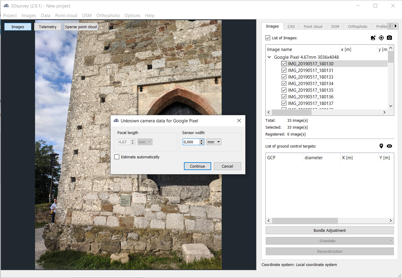
detailed instructions on how to best prepare and plan your flight for orthophoto generation.What cameras are supported in 3Dsurvey?3Dsurvey works with any drone and any camera. Some of them are already in our data base, if not you can manually set the focal length and sensor width or simply select ‘’estimate automatically’’ option.
Does 3Dsurvey support network processing?Currently not. Check
System Requirements or contact our
Support Team for further instructions on how to approach your projects for best speed and performance.
Can I process nadir and side images together?Yes. 3Dsurvey also works with oblique images.
For my present project, I require very high horizontal and vertical accuracy – let’s say +/-5cm vertical would be excellent. I plan to use GCPs collected using a cm RTK unit and I also plan to fly no more than 50m above the surface. Can your software produce elevation models that meet my requirements in terms of horizontal and vertical RMSE?Yes it can. End-result accuracy depends on several factors: flying height, camera type, number of GCPs and their setup. However, the rule of thumb is: accuracy=2x pixel size. Check the following documents for more details: aaaaa, bbbbb, ccccc.
What causes slow processing on computers with Quadro graphics cards?This issue is related to the driver for the Quadro GPU. Solution is the following:
A. Make sure that the latest driver is installed. If not, download the latest driver from
http://www.nvidia.com.
B. Change the options for the graphics processor:
1. Open Control Panel.
2. In Control Panel window select
Hardware and Sound and then click
NVIDIA Control Panel.
3. In the NVIDIA Control Panel window, in 3D Settings section, click
Manage 3D settings.
4. Under Global Settings select
3D App Game Development from the drop-down list.
5. Click
Apply.
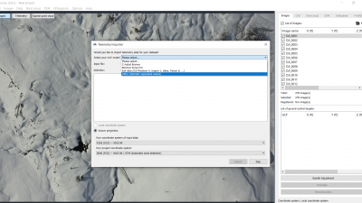
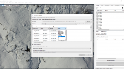
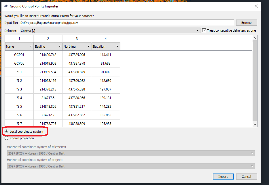
Why am I getting GCP and telemetry coordinate systems are misaligned warning?Most likely the GCP positions that were imported into 3Dsurvey are not in coordinate system, you have defined as Project coordinate system.
First check GCP coordinates and camera coordinates from telemetry:
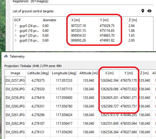
If these values differ significantly, then coordinate systems are set up incorrectly.
Second, if values seem similar, check the telemetry view:

If GCP positions are not showing up in same are as camera positions this again indicates, that we have incorrectly set up coordinate systems.
This will likely lead to lower accuracy of results.
To fix the issue, either set up coordinates system correctly, or use Local coordinate system option in GCP import wizard:
 Why am I getting warning: “Optimized camera parameters differs too much from initial values”?
This tells us that optimized focal length differs significantly from initial value. The initial focal length value was either loaded from our database (in case you use photos from a drone like for example Phantom, Mavic, Yuneec or Parrot, or a handheld camera that is in our system) or calculated from sensor width data that the software asked you to provide (in case you use photos from a mobile phone, or a camera that is not yet in our system)
If after image import software asked you for camera sensor width, it is possible that just the value provided was not accurate enough:
On the other hand if you did not see the “Unknown camera data” window pop up, then this warning indicates, that the results might not be optimal. This might be for a number of reasons. To name a few – incorrect coordinate system setings, incorrectly marked gcp postions, incorrect 3D position for just one or a few of GCPs...
In any case, if you receive “optimized focal length differs by more then 5% from initial value” we recommend you send us the aerial photos and saved project (*.3Dproject file) on
support@3dsurvey.si for inspection, and we will let you know how to best fix the issue.
Why am I getting offset between telemetry camera positions and GCP camera positions is too large warning?This error tells us that there is a likely error in either horizontal or vertical coordinate system setup. Software detects that there is a difference in camera positions calculated form telemetry data, and camera positions that the GCP coordinates imply. If this warning comes up, we recommend you to use Local coordinate system at GCP import instead of Known coordinate system, as this will tell 3Dsurvey to disregard camera positions calculated from telemetry and focus on GCP positions instead.
If you want to get to the bottom of why you are getting this warning, you can also send us you the aerial photos and saved project (*.3Dproject file) on support@3dsurvey.si for inspection, and we will let you know how to best fix the warning.